Class Name: Spatial Reference Frame Summary
Definition
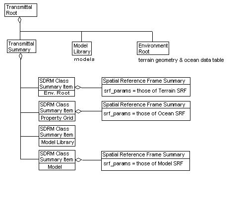
Summarizes a spatial reference frame that is used in a transmittal.
Primary Page in DRM Diagram:
Example
- A transmittal containing terrain geometry, an oceanographic
Property Grid and a number of
Models. The terrain is in one
spatial reference frame, the Property
Grid in another, and some of the Models
in a third (i.e. LSR).
FAQs
--FAQs needed here --Constraints
Component of (one-way)
Notes
Component of Notes
Class type that has this classification
Prev: Spatial Index Related Geometry.
Next: Spatial Resolution Level of Detail Data.
Up:Index.